Longmen Shan fault geometry and slip rates
2014
The Longmen Shan is the steepest topographic front at the India‐Asia collision zone and the site of the Mw 7.9 Wenchuan earthquake. To explain the interseismic GPS velocities across the greater Longmen Shan region, we developed a boundary element model including earthquake cycle effects, topography, the westward dipping Beichuan Fault and a ∼20 km deep, shallowly dipping, detachment, inferred from observed afterslip and from structural considerations. Prior analyses which had neglected the detachment and earthquake cycle effects found shortening rates near zero. In contrast, we found that interseismic GPS data are consistent with a shortening rate of 5.7±1.5mm/yr and maximum surface slip‐deficit rate of 9.5±2.5mm/yr. This model unifies the interpretation of geodetic deformation throughout the earthquake cycle and suggests that the Longmen Shan is an active fold‐and‐thrust belt with Wenchuan‐like recurrence intervals as short as 600 years.
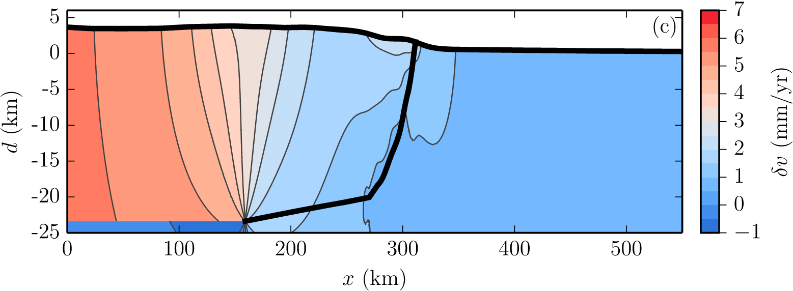 *A cross section of the Longmen Shan showing model-predicted velocities. Positive velocity is to the right/southwest.*