Topography and the shallow slip deficit inference
2018
Images of earthquake slip typically rely on flat Earth physical models to link surface observations to fault activity at depth despite the extreme topographic relief (20%) in vicinity of recent great earthquakes (e.g., 2008 $M_w$=7.9 Wenchuan). Here we use a three-dimensional boundary element approach to characterize the effects of realistic topography on coseismic slip inversions and find that near the steepest topography, the flat Earth assumption may induce errors $>100%$ in imaged coseismic slip. Additionally, we show that the flat earth assumption even in regions with small topographic gradients (1-5% , 1992 $M_w$=7.3 Landers) can lead to the inaccurate inference of a shallow slip deficit. This illustrates how physical model errors can be amplified by an order of magnitude in estimating images of coseismic fault slip and that more physically realistic models may be required for accurate inference in an era of rapidly growing geodetic databases.
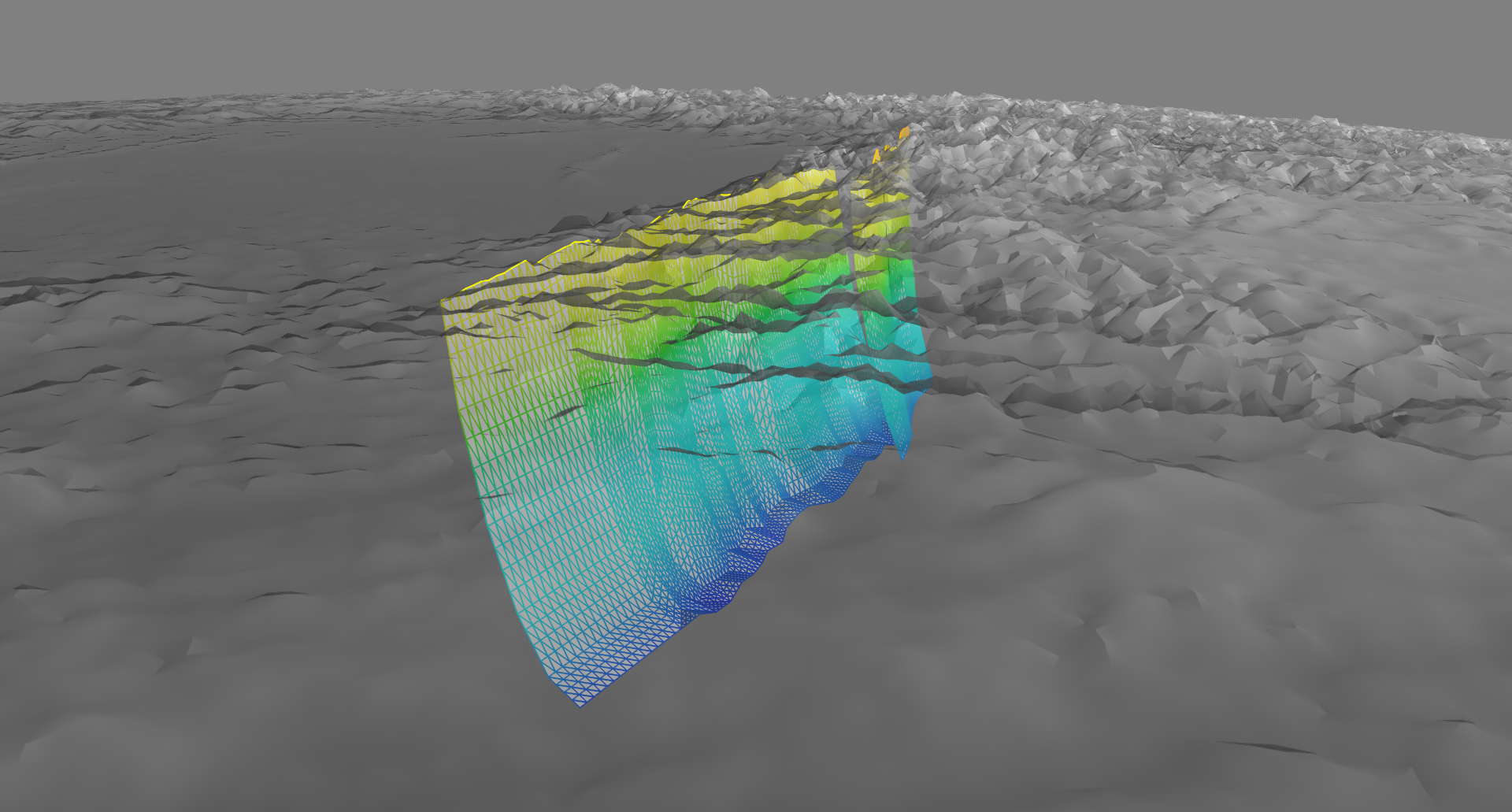
A view of the Wenchuan model looking south from high above the Earth’s surface at the fault model through transparent mountainous topography.
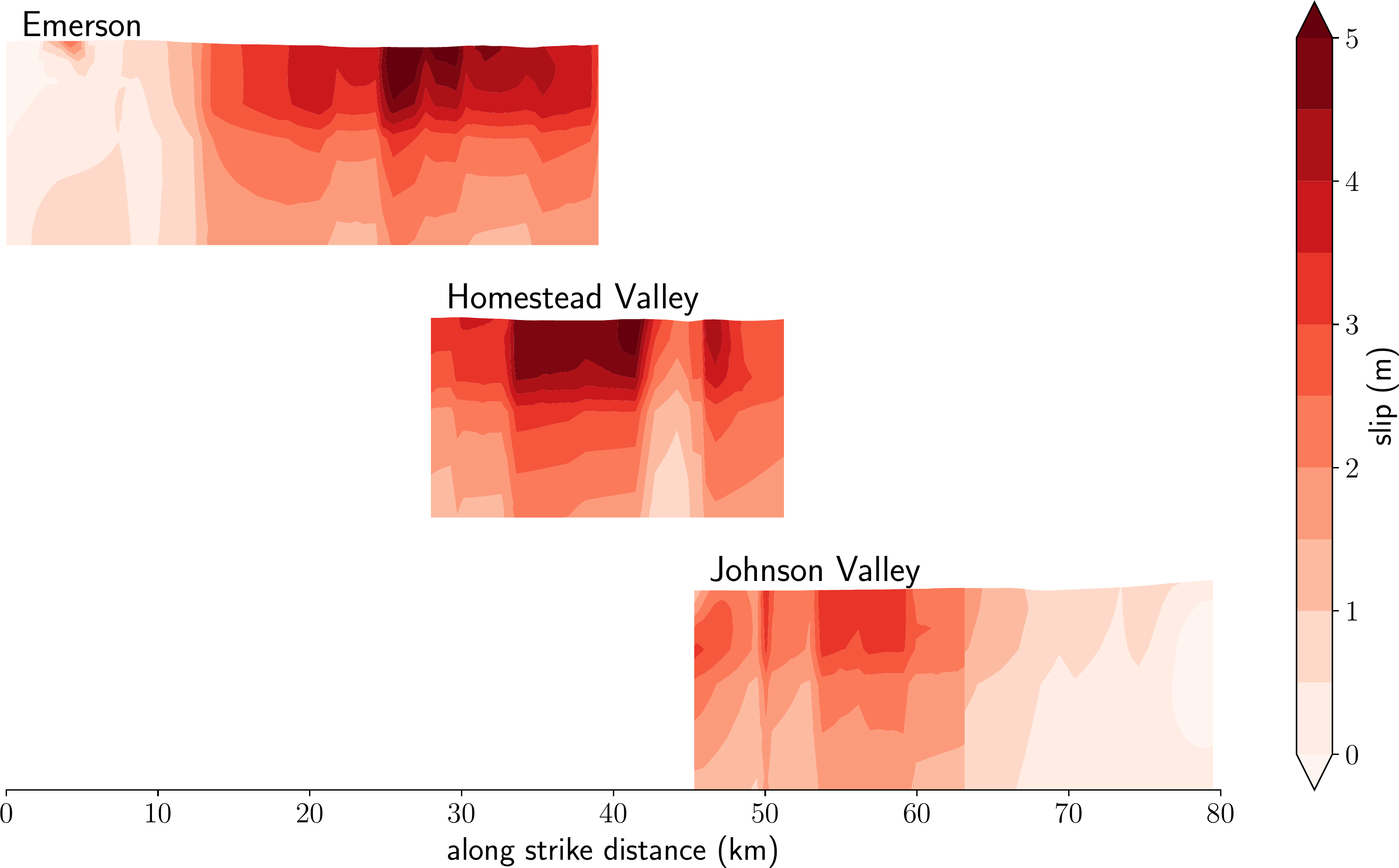
The distribution of slip on the primary segments of the Landers rupture surface as inferred by our model including topographic effects.